Share
New GO Bus network map will help customers find their way
First of its kind map is another tool available to make taking transit even easier.
May 2, 2024
In case you haven’t heard, Metrolinx announced changes to GO Train and bus schedules last month.
To help customers we’re debuting a new map, one that is the first of its kind for GO customers.
The GO Bus network map.
Up until now, the only map available to GO riders was a broader GO system map which covered both GO Buses and GO Trains.
The recently released map dedicated to GO Buses, changes that.
“It’s a significant leap in the information available to customers,” says Jimmy Wu, wayfinding advisor in Metrolinx’s planning division.
Wu says what makes this map special is customers can easily use it to plan their individual GO Bus journey.
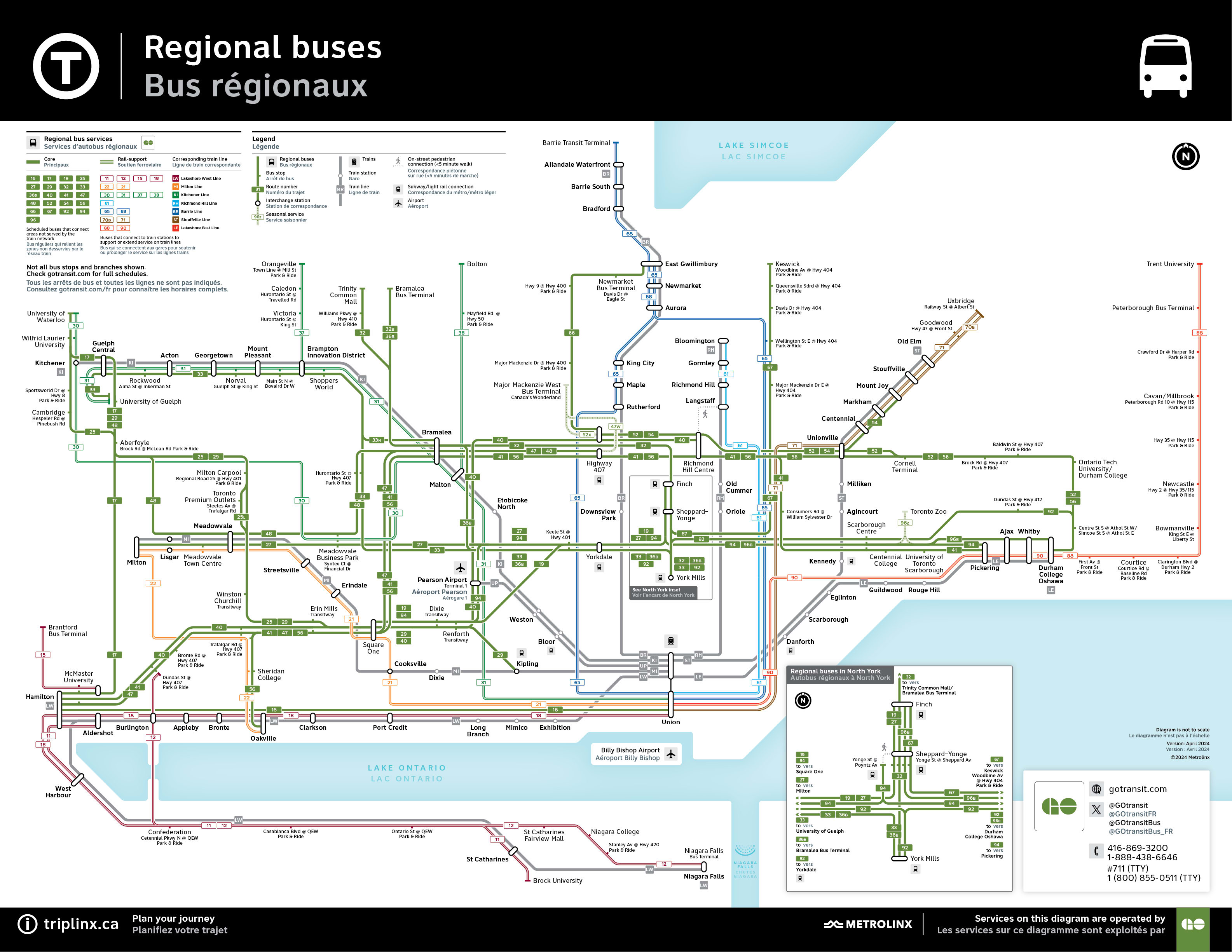
The new GO Bus network map. (Metrolinx graphic)
It also gives a level of detail which allows riders to differentiate different GO Bus routes and it highlights stops that are dedicated to bus travel.
Things like park and rides, bus terminals, it even points out seasonal routes like those to the Toronto Zoo and Canada’s Wonderland – which are also being reintroduced starting May 4.
“Providing this level of detail in a comprehensive way is really exciting,” says Wu.
“The real value here is customers can see all the different areas where GO Buses travel. As a customer, you weren’t able to do that before. Now you can see which route will take you to Bolton, Peterborough, or Waterloo for example.”
The goal is to help people understand the transit system better and feel more comfortable taking transit to get where they want to go.
You can take the GO Bus to Toronto Zoo and Canada’s Wonderland. (Metrolinx photo)
GO Bus network
Many people don’t realize how vast the GO Bus network is. Some routes cover more than 100 km!
Route 56 for example, takes customers from Oshawa to Oakville – stopping at many key stops along the way like Square One in Mississauga, Bramalea in Brampton, and connects to the TTC subway at Highway 407 Terminal in Vaughan.
Not only do GO Bus routes help get people across the region, they’re a key way for riders to connect to other transit options like the GO Train and TTC subway service.
Another first, the new GO Bus map highlights which routes support the GO Train network.
Each bus route is coloured on the map to make it clear which route supports which GO Train line. The Stouffville GO Line for example is the colour brown. GO Bus Route 71 is also brown on the map as it is the corresponding bus route for customers on the Stouffville Line.
“It’s kind of like an integrated family of routes – now wearing coordinated colours on our map,” says Wu.
And the coordination carries over to the brand-new digital screens rolling out at GO Transit and UP Express stations across the region too. Those same corresponding colours are now found on the screens at stations. Making it easier for you to spot your line, whether it’s bus or train service.
A look at Metrolinx's new digital screens. (Metrolinx photo)
GO Bus map launches online
You’re probably wondering where to find the GO Bus network map? We’re launching it online first.
The map was also designed in a way that it can fit in existing poster cases at GO Stations – the plan is to roll it out at stations and terminals in the future. Making it a nice complement to the overall system map already on display.
Like any good map, accessibility was a major consideration. It follows universal design guidelines as well as Canadian National Institute for the Blind best practices.
All in the name of making it easier to find your way, regardless of your abilities.

An example of the T symbol in use on the Eglinton Crosstown LRT project. (Dylan Farley Toombs image)
Integrated transit network
Maps are just one of the ways teams at Metrolinx are working to harmonize wayfinding across the entire transit network.
Wayfinding being the catch-all term for the science behind the ways in which people orient themselves and navigate from place to place.
If you aren’t familiar with the ‘T’ symbol – the new GO Bus map is also the first map Metrolinx has produced that will feature the universal transit symbol. Right now, the ‘T’ is featured on GO Bus signs, and will be on signs at new rapid transit stations. It will also be something found on future transit maps as well.
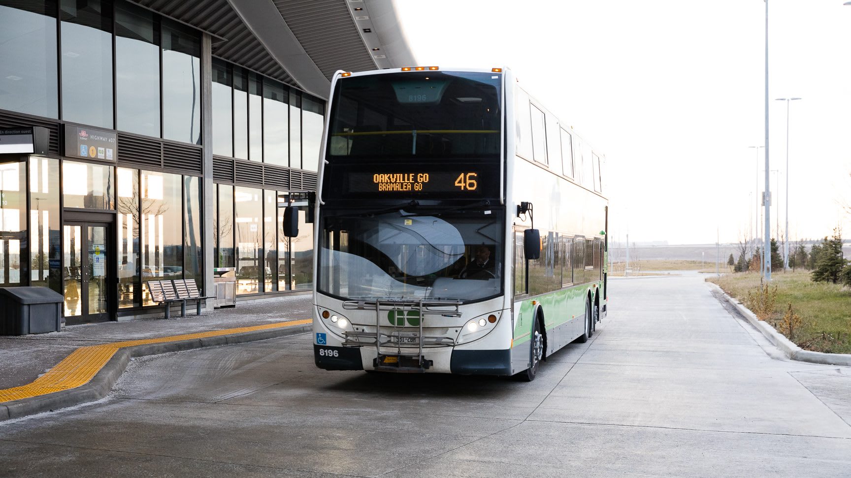
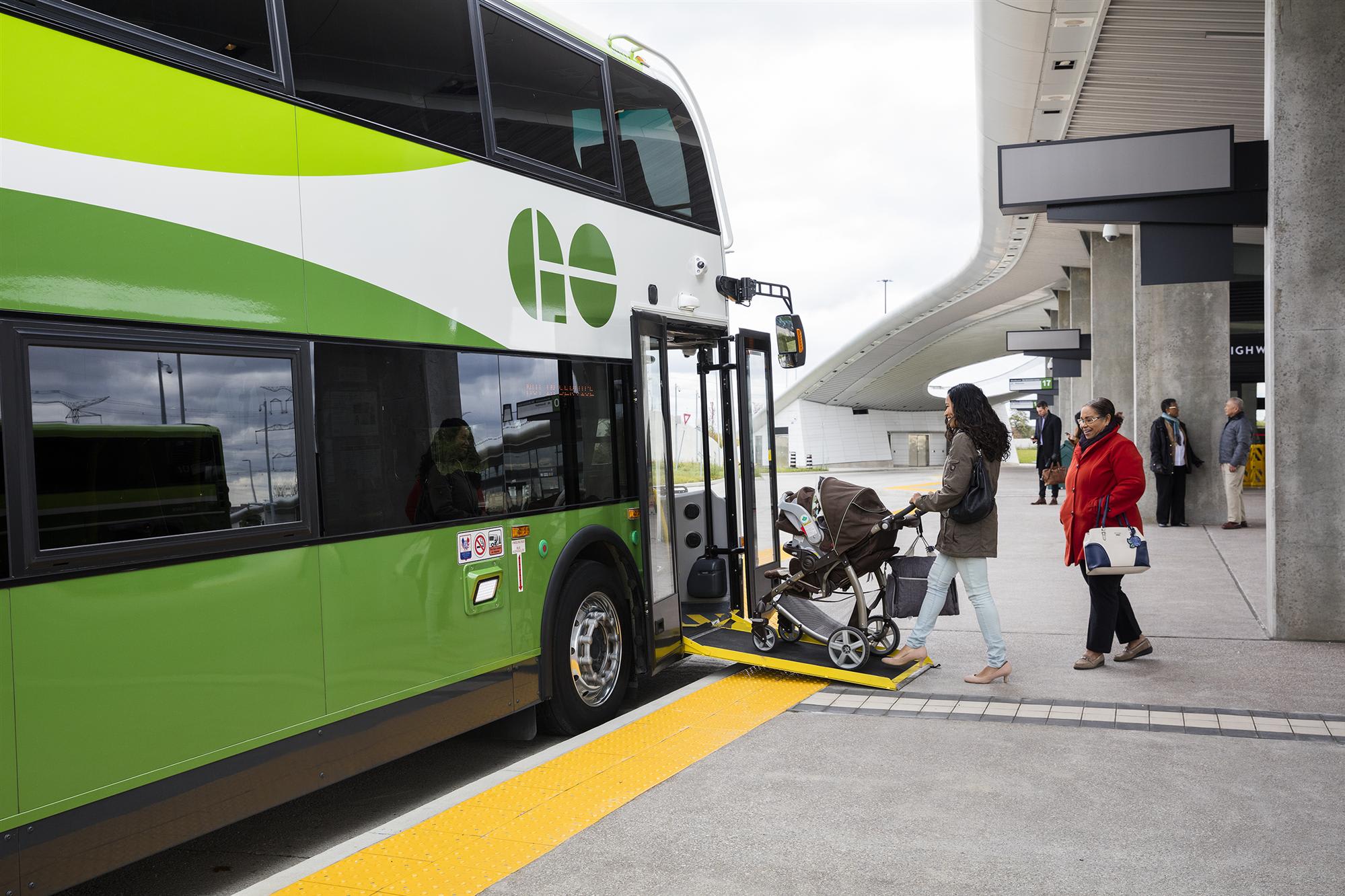
A GO Bus pulling out of a station. (Metrolinx photo)
What’s coming in the future?
So, what’s next for the wayfinding team at Metrolinx?
“We’re working on another map that will help bring different transit systems into one map,” says Wu.
Part of a wayfinding harmonization pilot, the future map will feature the GO train network plus the existing TTC subway lines, and show where you can make connection to streetcars, and buses.
It’s significant because current maps have only one transit agency represented, and customers would need to reference separate maps depending on if they’re using GO or TTC for example. This is another part of Metrolinx’s efforts to make taking transit a more seamless experience.
“We want to give customer one trustworthy source of information, so you don’t need to search around for different maps by different agencies,” Wu adds.
Six major projects are being built in Toronto right now that will add three brand new lines to the rapid transit network and significantly expand three existing lines. Further west, Mississauga and Hamilton are each getting their first light rail transit routes.
The plan is to integrate this new regional map into these new rapid transit lines as they are finished.
All part of our plan to improve and build more transit to ultimately reduce congestion and help make travel across our region easier, more affordable and sustainable.
by Scott Money Metrolinx editorial content manager